This is a long delayed update. I spent my last days in the US in California before departure. During those few weeks, I visited a few parks and scenic drives and attended the AGU fall meeting.
17-mile drive. This is a famous beach-side drive to the south of the bay area. Lots of luxurious houses by the road. The Pacific was restless.
My first birding experience with Cin-Ty, and lots of other people including Roberta. Yes, it happened after I worked with Cin-Ty for three years, right before I departed for Beijing…Roberta gave me a big hug when we met on the trail. Cin-Ty organized this pre-AGU birding expedition. It was in the bay area. The team had a dozen of geologists. I have to say I didn’t even know where to look…but it was a very pleasant morning. They were all equiped with different kinds of long-reaching binoculars/monoculars and DSLRs. I only brought a compact camera with me…
Wonderful weather on that morning.
Another trip to Point Reyes. Can’t remember how many times I visited it. I got fascinated with this cape since Xin and I found it back in 2015, near the end of our cross-country drive from Maryland to California. Each trip to Point Reyes had been different, but I missed the very first one. It was a foggy and gloomy early afternoon in January. Xin and I were wandering on the beach. The bluish Pacific was wavy. It was a bit chilly. No one else were on the beach.
We visited Lick Observatory. It is a historic mountaintop observatory.
Overview of the mountains from Lick Observatory.
Sunset. Driving back from Lick Observatory.
Sunset.
I believe this one was taken on Thanksgiving day last year. We were driving back from Russian Ridge in the bay area. This place was suggested by Jackson, my officemate at Rice.
Life restarted after I came back. Lots of things changed. It was a bit difficult to get used to it at first. But Kang and my PKU colleagues helped me a lot. I rented an apartment, smaller than the one I stayed in in Houston. It is expensive but the location is excellent. Three km from the university. There are dozens of supermarkets and hundreds of restaurants in walking distance.
Used to keep two SIM cards, one for the US and the other for China. I swapped them when I travelled back and forth between US and China. No need to keep the eight years old US SIM anymore.
Got my university email and stopped using Gmail as my primary email. I reset the Mail apps on both my computers and cellphone.
Put away all my credit cards and US driver’s licence.
No more driving but there are a lot of shared bikes by the streets.
My US dota ID doesn’t work anymore.
I’m not a student or a post-doc anymore.
Don’t need to cook anymore.
Don’t talk to people in English anymore.
Beijing is colder and much drier than Houston in winter.
]]>Xin and I were wondering where to visit in late September. We thought about Yellowstone, which I had always wanted to visit but never hashed out a real plan. The airfares were way too expensive plus Xin had already seen it, so we gave up… Rocky Mountains in Colorado were also on our list, but I was worried about the crowd…Then Glacier came up.
Glacier National Park is something that seems so remote and isolated. It’s in Montana. I had known Montana only from the movie “Arrival”.
There we went.
It was chilly in Montana in late September. Most trees there already turned golden, fervent but quiet. We spent four days in Glacier National Park area. The park is divided into the east and west segments with the continental divide running through in the middle. The climate was drastically different between the east and west sides. The west side was generally very mild. It rained a little bit and the temperature was always above freezing point. The east side changed from day to day, and was on someday rattled by snow storms. The east side was eventually closed due to severe weather conditions. It took about 1.5 hours to drive from west side to east side, and we did this very single day in our four day trip there. The drive was very scenic with no traffic.
First night. We went to a theater in Whitefish after dinner. The theater is small with two rooms and one staff person. I very much enjoy watching movies in small theaters in remote towns. Feels like in a different world.
A boat floating on Lake McDonald, the biggest lake in the park area. There was not much to see on the west side of the park. It was gloomy on the west side all the time.
My last NP stamp bought and stuck in Apgar Visitor Center on the west side.
Golden tree leaves captured on our way to the east.
Grass rolls?
Chief Mountain on the east side. It cleared up for two hours–the only two hours of good weather on the east in our entire trip.
It became gloomy again on our way back to the west.
Fall colors.
Driving back to the west.
Xin enjoying the scenary.
Outside Saint Mary Visitor Center on the east side. Our second trip to the east.
White, gray and yellow.
Our thrid trip to the east.
Driving to Two Medicine Lake.
Our fourth trip to the east…Last try. We were so persistent because all the fun trails, including the Grinnell Glacier Trail, is on the east side. We had to head back because of the snow and icy roads…
We stopped by this East Glacier Park Village twice to eat lunch and buy stuff. There was a nice little cafe called Two Medicine Grill. We stopped for hot drinks before turning back. While waiting for our hot chocolates, we found that this cafe had a Instagram. People were taking pictures with this dog right here four years ago…
So, we didn’t see the glaciers in the end because of the weather on the east side…
]]>“English?” I asked.
“A little bit!” She answered with a very dramatic gesture using her fingers.
…
At least she could understand numbers in English and that was enough. We figured out everything and both felt very satisfactory about our successful collaboration. I said:
“Gracias!” (which means “Thank you” and was pretty much the only Spanish word I could say).
She was a bit surprised and we both laughed out.
Travel route: Barcelona-Calp-Consuegra-Toledo-Segovia-Madrid-Barcelona.
Barcelona after sunset. We enjoyed this beautiful panaramic scene when having dinner at El Xalet de Montjuïc. Spanish people usually eat dinner after 9 pm, which is very late by most standards. And they chat on until midnight…We spent two days at the beginning and the last day of our trip in Barcelona. It was a wonderful place, very relaxing. It is compact and with great public transportation systems. One can get anywhere fast and easily. There are many attractions in Barcelona. I just forgot to take pictures sometimes…Near the top left corner is Sagrada Familia under construction. We visited it on the last day.
Inside Santa Maria del Mar. It is a famous church in Barcelona, very close to the beach. “Mar” means sea in Spanish.
Catedral de Barcelona, another famous church.
Man sitting beneath the Arco de Triunfo in Barcelona, looking at his cellphone.
Me sitting in front of Catedral de Barcelona.
Giant columns inside Catedral de Barcelona.
Boy hopping between rock blocks in Park Guell. Note the doodles on the blocks.
We rented a car to drive around and see other places in Spain. It was a BMW! Not that expensive after all and Japanese and American cars are not very common in Europe. After departing Barcelona, we drove straight to Muralla Roja in Calp, Alicante. Muralla Roja means red wall, and is an apartment complex. It was designed by Spanish architect Ricardo Bofill in 1968. It is said that the smartphone game “Monument Valley” was inspired by Muralla Roja. There are indeed a lot of “Monument Valley” elements here. One has to stay in this apartment complex in order to get in, which is very expensive. We spent over 300 euros for one night…But Xin thought it was well worth it…
A family taking pictures. I like the triangle they made.
Me sitting on muralla roja.
Local people getting ready for dinner!
Looking out on the roof of Muralla Roja.
Muralla Roja.
The town of Calp is awesome. Every single house apartment and store there has its artistic style.
Food in Spain never let us down. And it is not expensive! A cappuccino costs only 2.5 euros (~2.7 US dollars) as opposed to > 4 dollars in the US. Tips are not necessary in Spain (and most countries in Europe, I believe). Tax is included in the prices on the menu, much like in China.
Xin standing by a blue window.
We then drove to Toledo via Consuegra. Behind the historic town of Consuegra, 12 windmills stand on the top of Cerro Calderico mountain. These iconic windmills are said to be those described in the 17th-century novel Don Quixote.
Xin looking up at one of the windmills.
The town of Consuegra.
Vast farmlands on the other side the hill.
Monasterio de San Juan de los Reyes in Toledo. Toledo uesd to be the capital of Spain long ago.
Alcázar of Segovia, a medieval castle. See here. The Alcázar was originally built as a fortress but has served as a royal palace, a state prison, a Royal Artillery College and a military academy since then. It is currently used as a museum and a military archives building (Wikipedia).
Restaurant on the stairs. Most restaurants have outside seating and people love to eat outside.
Segovia is a beautiful and peaceful historic city. The city center of Segovia was declared World Heritage by UNESCO in 1985. With a population of about 50,000, Segovia is more like a town, and local people and tourists are well blended and enjoy the relaxing life together here. Some restaurants have pianists playing live music.
View of Alcázar of Segovia from our hotel balcony.
Segovia is also famous for cochinillo asado (roasted baby pig). We tried it at a famous restaurant by the El acueducto de Segovia, but were not extremely impressed…
Old couple sitting on a bench by a temple-like building.
Mercado de San Miguel in Madrid. A great market place for hanging out and trying local foods.
Man introducing wines (?) in Mercado de San Miguel.
Getting back to Barcelona.
Inside Sagrada Familia. We booked tickets to visit Sagrada Familia on our last day in Spain. Sagrada Familia is different from any church we have ever seen. It has a lot of nature elements, and, to my understanding, represents a universal hymn to god, nature and all good wishes. What a magnificent piece of art! It was designed by Spanish architect Antoni GaudĂ. GaudĂ passed away in 1926, but Sagrada Familia is still under construction and will be completed in 2026, the centenary of GaudĂ’s death. This is a placed that shouldn’t be missed if one visits Barcelona, no matter what he/she believes in.
Jesus beneath a canopy.
Door of Sagrada Familia.
]]>Our team was smaller this year, with only four people. We rented two Toyota Land Cruisers and two local drivers, as we did last year. Nyingchi was rainy and wet, but it actually helped because otherwise it would be very dry with rediculously high UV.
Mountains in the clould? Mist?
Highland barley and rape flower farmlands in fluvial deltas.
Goats!
Time for picnic!.
Our local drivers, waiting for lunch.
A yak! They look strong and scary, but they are actually very timid and never come close to us.
Village in a valley. The weather was getting dry.
“Food???”
Driving at 4700 m.
Storm ahead.
One morning in Lhasa.
Reflections in Yalung Zangbo River. I took this picture when Xu and the students were collecting rocks on the other side of the road by the river.
Light and shadow in a valley. There is a lot of sand accumulating on the slope of the mountains. At the bottom of the valley there are a few houses and some trees. Look like an oasis in the dry mountains.
Xu and the students were collecting samples from a skarn outcrop.
A shot taken through the plane window. Snow peaks hiding behind the cloud.
Our team!
]]>In the past several years, my most visited states in the US are Arizona and California. During my dozens of flights across the western US, I liked to stare at the vast mountainous lands through the airplane windows.
It was fascinating. Wild, primitive, barren and lonely. The photo below was taken on one of my fights to California. In this photo, the reader can probably see many signs of river washout in these mountainous areas. There were probably more mountains on the continents.
Fig. 1. View of western US from airplane. I took this photo on one of my flights to California.
Why are there so many mountains on the continents?
A little more than two years ago, I came to Rice University to continue my research on Earth’s continents. I was offered a set of very special samples. These rocks are from 50-80 km beneath the surface, and are probably the deepest crustal rocks that humanity can ever get. Up to now, the Kola Superdeep Borehole, drilled by the Soviet Union, still holds the record of deepest artificial point on Earth (12.262 km). So obviously, these rocks were not dug up by human. They were brought to the surface through some violent volcanic eruptions. Our samples are from central Arizona. They are composed of various minerals that crystalized from mantle magmas as they just rose into the crust. In geology, this type of rock is called cumulate.
Fig. 2. Superstructure of the Kola Superdeep Borehole in Russia, 2007. Today, Kola Superdeep Borehole still represents the deepest artificial point. Image from Wikipedia.
Although cumulates are usually deep seated, crustal cumulates from this deep are scarce. 50-80 km is about twice that of the average continental crust thickness. This is very unusual, and only the crust beneath the highest mountains can be built up to this thickness. Every piece of rock has its story. What can we learn from these rocks from the deepest crust?
Niobium (Nb) and Tantalum (Ta) are probably unfamiliar to most people, but geochemists have a strong passion about them. They are two metal elements, buried deep in the periodic table. Nb and Ta are very rare in Earth’s crust, a few parts per million or less. They have almost identical chemical properties and behave in pretty much the same ways in most geological processes. Their ratio is constant in Earth’s mantle and the magmas that come from the mantle. When there is more Nb, there is more Ta; when there is less Nb, there is less Ta too. They are twins.
Geologists have long noticed that the ratio of these twin elements is a little different in Earth’s continental crust—Nb is off—it’s lower than it should be. The twins are now separated with some of the Nb being missing in the continental crust.
Fig. 3. The twin element ratio Nb/Ta in Earth’s mantle and continental crust. The mantle Nb/Ta is measured by oceanic basalts (MORB and OIB). These basalts set the reference line. The continental crust Nb/Ta is shown in three ways. One is the model composition (Bulk CC) from my Ph.D. advisor Roberta Rudnick’s famous paper on Treatise on Geochemistry. The other two datapoints represent the average Nb/Ta in shales and diamictites. Geologists use these two types of terrigenous sedimentary rocks to obtain the average composition of the upper continental crust.
Who could have separated Nb from its twin element Ta, and where did the missing Nb go? The missing Nb has been a mystery in Earth’s science, and for decades, geologists have been searching for this missing Nb.
The missing Nb presents a mass non-conservation problem, meaning that some important linkages in the chain of continent formation are missing. The missing Nb could be stored in a hidden crust in the deep Earth. We can’t see and know very little about this crust, but it must have been generated together with the continents. This hidden crust is a dance partner of the continental crust.
Is it possible that our Arizona cumulates tapped this deep hidden crust? We can test this by measuring the twin elements and see if there is an excess of Nb.
I sent the samples to my collaborator, Kang Chen, in China University of Geosciences, Wuhan. He did the painstaking analyses of Nb and Ta compositions in these rocks. While waiting for the results, I surveyed the GeoRoc online database for global rock geochemistry, hoping to find something interesting. I was looking at the compositions of rocks from global volcanic arcs. Volcanic arcs form at plate boundaries where one plate subducts beneath another. In volcanic arcs, new crust with felsic compositions is being generated today. But surprisingly, not all felsic magmas from volcanic arcs show the missing Nb signature like the continental crust. Actually, it is only in places like Andes in South America where the felsic magmas are consistently depleted in Nb.
Fig. 4. Andes mountains on the west coast of South America. Image from web.
Andes is unique among volcanic arcs today. It has the longest mountain range on Earth, spanning over 7000 km on the west coast of South America. With an average elevation of about 4000 m, lands are extreme in Andes. Ojos del Salado located on the border between Chile and Argentina is the highest elevation volcano in the world (6893 m).
Fig. 5. Ojos Del Saldo volcano in the Andes, with an elevation of 6893 m, is the highest elevation volcano in the world. Image from web.
We know that the basaltic mantle magmas feeding the Andean volcanos have just the perfect Nb/Ta ratio, but after the magmas differentiate in the crust and ultimately make it to the surface, some of the Nb is missing. So, what’s going on in the deep crust beneath the Andes? Unfortunately, We don’t have samples from the deep crust beneath Andes, but the ones from Arizona provide an excellent analogue.
Kang finished the measurements and sent the data to me last spring. The results confirmed our hypothesis—the missing Nb from the continents found! These deepest crustal rocks are exactly the critical missing part of the entire continent jigsaw puzzle.
Then a question arises: why would the missing Nb happen only in those extremely mountainous volcanic arcs? In the Arizona cumulates, we found a special mineral—rutile. They are small, only a few tenth of a millimeter. They can only be seen under microscopes. We used a laser ablation technique that allowed us to take samples from very small minerals. Our microanalyses show that rutile is the mineral that can separate Nb from Ta and preferentially grab Nb from magma and put it into its lattice. Rutile is a mineral that we don’t usually see in magmas. It can only crystallize from magmas when the pressure is sufficiently high. After realizing this, everything starts to sort out by itself. It’s only at the roots of giant volcanos where the pressure is great enough to “squeeze” out rutile from magmas.
Fig. 6. A rutile crystal (redish) in our samples. It’s about 80 micron in diameter, a little more the thickness of human hair.
Now the message from the missing Nb is clear: perhaps, just about every piece of the continents was born like the Andes. The lands that we live on, though most of them look flat and peaceful today, all started with massive plateaus and giant volcanos.
Where did the mountains go? After building them, nature stops at nothing to destroy the mountains. Together, erosion, weathering and gravitational collapse conspire to bring mountains down in just a few million years. Rocks are turned into sands, soils and dust. These fine particles travel with rivers and fly with wind, and spread out to the entire world. When these “dirts” dissolve in water, they give off life-essential nutrients that feed microorganisms, then plants, then animals, and all the way up the hierarchy of life. Chemical weathering of the eroded rocks and minerals also consumes the greenhouse gas carbon dioxide in the atmosphere, and ultimately buries it as carbonates in the oceans, which cools off the surface of our planet.
As mountains rise and fall, life prospers.
Fig. 7. I took this photo last year in Tibet as we drove around Yamdrok Lake. In just about every glacial valley, where a stream runs down the mountains, there is a village. Lands are probably more fertile in the valley.
]]>House on cliff, Half Moon Bay.
Kids playing in the redwood forest.
In tide pools, there are crabs, sea anemones, fish, shrimps, and sometimes even octopus. A dad was helping his kids to cross a tide pool.
A sea anemone!
The redwood forest in Half Moon Bay.
Cat sitting behind window, staring at us.
People playing on the beach at Point Reyes. That afternoon we drove 2 hours to get there, stayed for one hour or so and spent another 2 hours to drive back. Crazy…
Woman wandering on the beach
Woman sitting on sand dunes taking pictures.
Man sitting and meditating on a cliff at Lands End
]]>I flied to California to spend the end of the year with Xin. We then visited Seattle and did a road trip in the Olympic Peninsula. Winter is somewhat an awkward time to visit Washington because it rains a lot, but we have visited so many places in their not-so-good time of the year. Worse still, both the Olympic and Rainier national parks were closed because Mr.Trump shut down the government…In the end, we visited some other places in the area. Still fun.
A seagull standing on the fence, Seattle. It was Christmas Eve, and the weather was surprisingly good! No rain and not cold.
Xin standing in front of the famous Market Theater Gum Wall.
A guy playing guitar and singing by the door of the very first Starbucks coffee shop.
Another singing guy. Why is his guitar so small…
View of Seattle and the distant mountains from the Space Needle.
Seattle at dusk and Mt.Rainier in distance. It turned out to be the only chance we could see Mt.Rainier in this trip.
Starbucks Reserve Roastery!
A barista explaining how they make coffee.
Starbucks Reserve Roastery.
In the Starbucks Reserve Roastery, you can see how they roast beans and make coffee from them.
Coffee beans.
Barista making coffee.
Tubes on the ceiling transporting roasted coffee beans?
What are they doing with the beans?
A great breakfast in the Starbucks Reserve Roastery.
Ediz Hook Reservation for Native Birds.
Xin walking on tree logs with a bird behind.
Xin holding some seaweed whose roots grabbed a stone. Feel the power of seaweed!
Dungeness County Park. The left side is the Pacific Ocean and right side is the Dungeness Bay. This exposed seashore extends 5 miles and at the end is a lighthouse. We arrived late and could only finish 3 miles before heading back. It was a great walk!
Dead wood.
Xin and dead wood.
People heading back.
Dusk.
Xin playing with seaweed…
A seal!
Driving around the Olympic Peninsula in rain.
Lake Sutherland.
Lake Crescent.
A male deer! The Olympic national park has one of the very few temperate rainforests in the world.
Hiking on the Marymere Falls Trail.
Ruby Beach in winter rain, like the end of the world…
Ruby Beach.
Back to Seattle. Discovery Park.
A homeless guy feeding and then swatting away pigeons by the street.
]]>Tibet is special to geologists, nature enthusiasts, or everyone perhaps. It is the largest mountain belt/plateau in the world. Tibet is home to numerous high mountains, including Mt. Everest, the highest peak in the world. It is the roof of the planet. Tibet is unique its landscapes, climate, ecosystems, people and culture. Tibet is high and lonely. It is far less accessible than other mountainous areas, and remains as one of the least known places in the world. Tibet is an extreme land.
Tibet started to rise somewhat 50-70 million years ago, and is still rising today. The rise of Tibet is due much to the collision between India and Asia. Tibet is a facinating place to study geology. It’s a complicated dynamic system and just about everyone in Earth sciences can find something to his/her taste in Tibet. We landed in Lhasa on 7/6, took a break on 7/7 and started off our journey on 7/8. The altitude effect was always there, but I got used to it after a couple of days. My fitbit Alta HR recorded a gradual increase of my resting heart rate from < 60 to 75 in the first week. I knew my body was adapting to the low oxygen.
Farms of highland barley (青稞). Rice and wheat do not grow well in Tibet due to the lack of water. Highland barley instead is the staple food here.
In the remote areas, many villages have only a dozen of households.
The rain is coming. Summer is the wet season in Tibet, and we had quite a lot of raining days during the trip.
Our Tibetan drivers were testing the performance of the Toyota Land Cruisers while we were looking at the outcrops.
Rape flowers are very common in Tibet, something unexpected!
Weiqiang was giving some introductions about the local geology at this outcrop of Dazhuka conglomerate. It was near the end of that day.
Sparrows eating barley.
Wenrong looking for outcrops.
Beryl (a pale green bar) and garnet (red clusters) in leucogranite quartz veins.
Gyantse County (江ĺśĺŽż) at dusk, with Gyantse Fort in the background.
Making orders in a restaurant in Gyantse.
Gyantse Fort.
A remote village in the vast wild land, like an island. Altitude was > 4,500 m.
A mini store at 5,300 m. Didn’t get a chance to walk in.
A valley.
A village sitting in a U-shaped valley carved by glaciers.
Yamdrok Lake, one of the three largest sacred lakes in Tibet. See here
Yamdrok Lake.
Highway running in the valley.
Potala Palace at night.
It was very eazy to get contrasty pictures in sunny days. Driving from Lhasa to Nyingchi.
Driving from Lhasa to Nyingchi. Nyingchi is lower in altitude, and is such a beautiful and clean city. It’s a gem on the edge of the Tibetan plateau.
Xu was taking notes in the car.
Road crews were cracking and removing fallen rocks on the road.
Monkeys on the cliff!
Wenrong was examining an outcrop at dusk.
Xu and Wenrong walking down a hill near Tsetang.
Local people doing rituals at their village entrance before dusk. The giant rotating prayer wheel is believed to bring good luck to the people.
Water rushing beneath a wooden bridge.
Power poles on the mountains, sending electricity to villages scattered throughout the plateau.
Tibetan condos.
Highland Barley Festival!
Grasslands at 4,700 m
Yaks! I had thought that Tibetan yaks were dangerous and might attack people, but it turned out that they were very mild and tended to run away from people…
Collecting samples at 4,800 m.
A service station?
Mountains in distance.
A beam of sunlight penetrated the cloud, shining on a mountain slope.
Road in Tibet.
Kids running down a hill. They told me they were flying paper planes.
Xu and Weiqiang were climbing.
Mist in the mountains.
The back of Potala Palace after sunset.
Man sitting in a souvenir store by the Potala Palace.
A little Tibetan kid was playing by the street, and suddenly found me taking pictures of him when he looked up.
Metal flower statues. The last night.
]]>Iron (Fe) is one of the elements that we are most familiar with. It is a critical resource that drives modern civilization. We use things (partially) made of Fe everyday, from forks and spoons in the kitchen, cars on the road, frame structures of buildings, to rockets flying into space. Biologically, Fe is also an essential element. In our bodies, hemoglobin and myoglobin use Fe to form complexes with molecular oxygen. People who have deficiency of Fe may suffer from anaemia.
Indeed, Fe is very important, and the world would have been completely different without Fe. But, too much Fe can also be a disaster.
Iron has three valence states in most natural materials: 0, +2 and +3. The metallic Fe and Fe2+ are reduced, meaning oxygen-loving, and can react with oxygen to form Fe3+ — the oxidized, or rusty Fe. Within Earth’s interior, Fe is mostly in the 0 and +2 valence states. If these oxygen-loving Fe atoms/ions are transported to Earth’s surface, they may “eat” much of the oxygen in the atmosphere and kill most of the animals, including us, by anoxia.
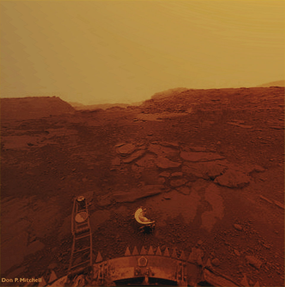
Fig. 1. A colorized photo of the surface of Venus. It was taken by Russia’s Venera 13 spacecraft on March 1, 1982
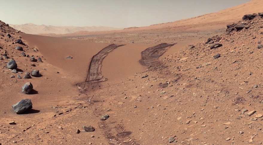
Fig. 2. View of Mars surface photographed by the Curiosity Mars rover. Image credit: NASA, JPL.
Fortunately, Earth’s continental crust, which is the land we are living on, is depleted in Fe compared with the crusts of other rocky planets in the solar system and Earth’s low sitting ocean crust. The upper part of Earth’s continental crust has about 4% Fe by weight, while the surfaces of Venus and Mars have about 8% or more Fe. This already makes a huge difference, and even more interestingly, most of that 4% Fe in the rocks is already oxidized and will not react with oxygen in the atmosphere produced by photosynthesis!
Why is Earth’s continental crust depleted in Fe and so oxidized? How did this crust form? Why is Earth the only known rocky planet to have this type of crust? Why are we so special? Perhaps, without this Fe depleted crust, life forms like us could have never existed on Earth. For decades, geologists have been seeking to understand what causes Fe depletion in the formation of the continental crust.
Given the right conditions, Earth’s mantle can melt and produce magmas that rise and form crust when solidified. During its ascent, a magma gradually cools down and continuously crystallizes minerals. These minerals are usually denser than the magma and will sink. We call this process crystal fractionation. Because most of the crystallized minerals are compositionally different from the magma, the magma will keep changing its composition as it rises through the crust. Naturally, you might expect that those Fe depleted magmas must have crystallized some Fe rich minerals and dumped them during ascent. This is also what we geologists think, but the questions are what are those Fe rich minerals and under what conditions can they form?
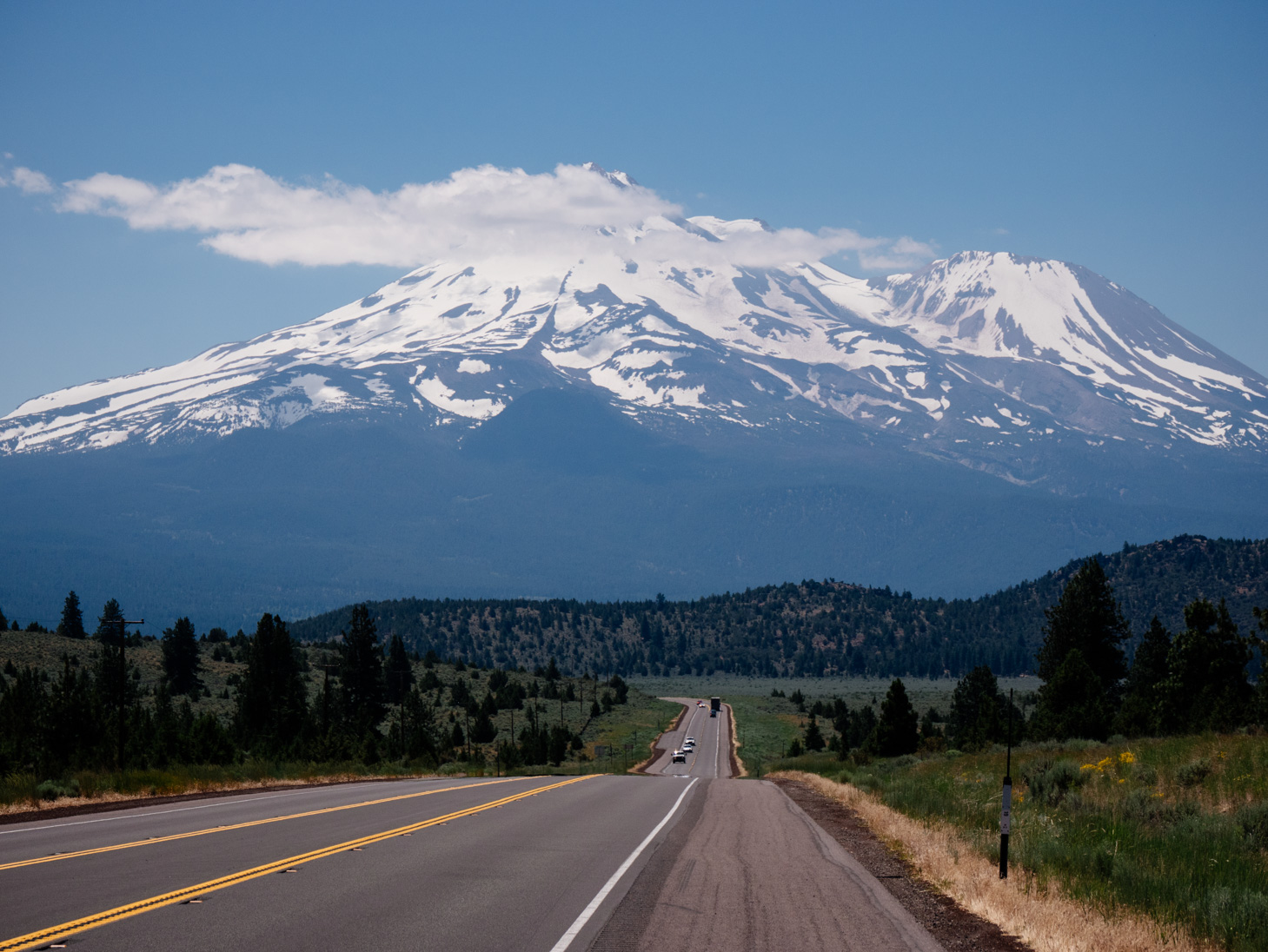
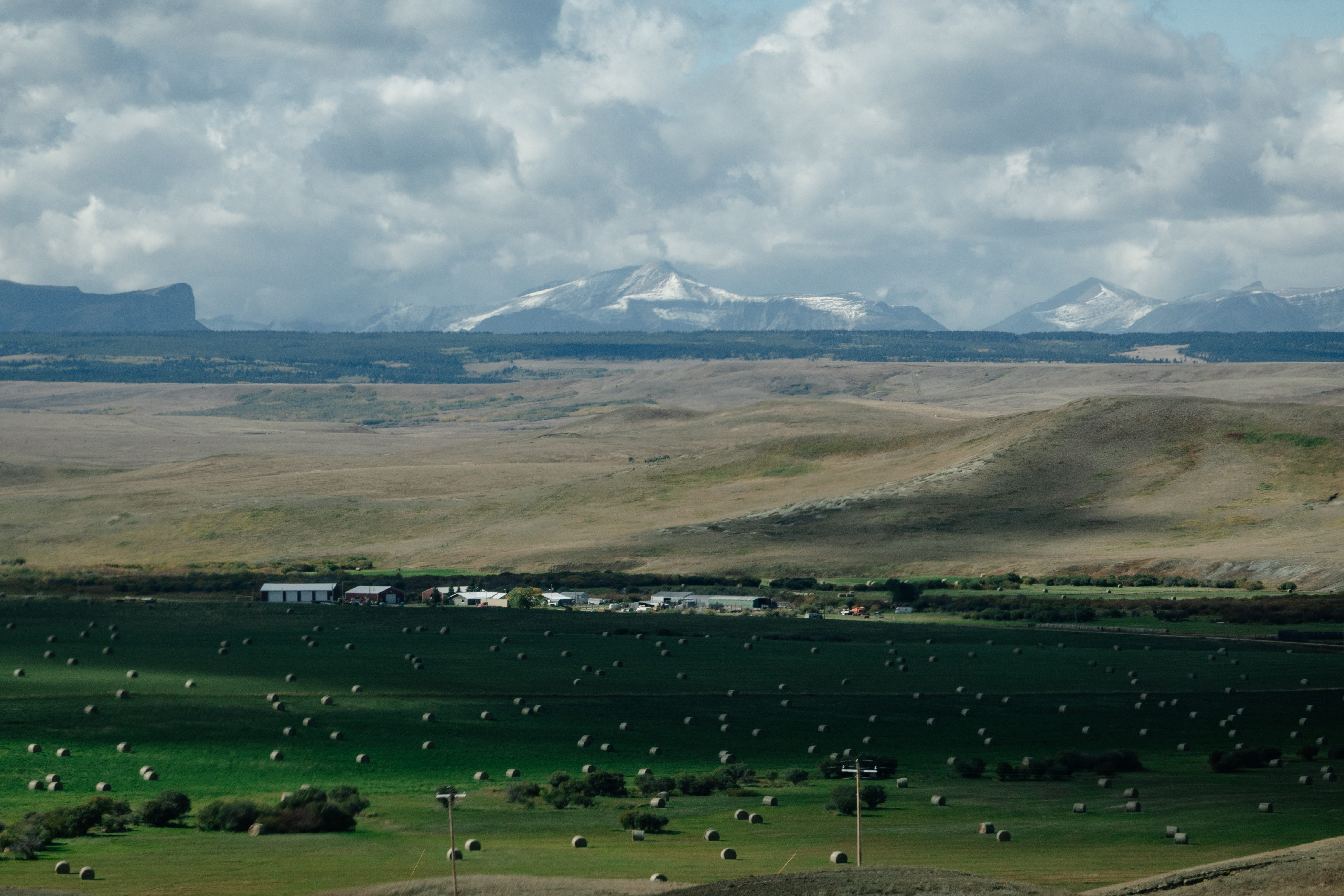
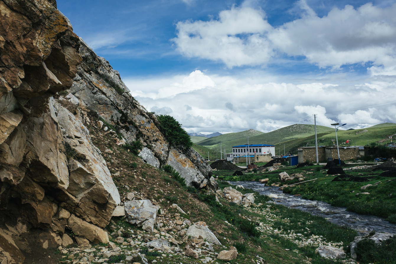
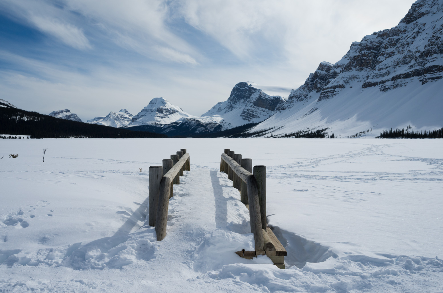
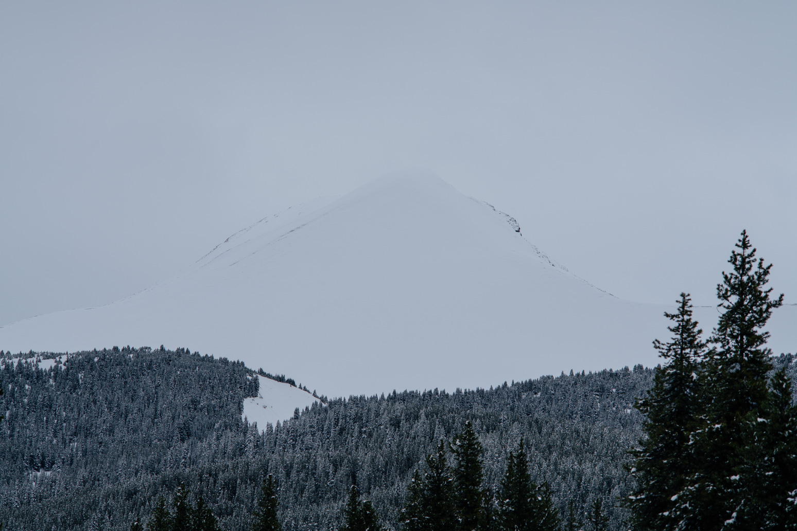
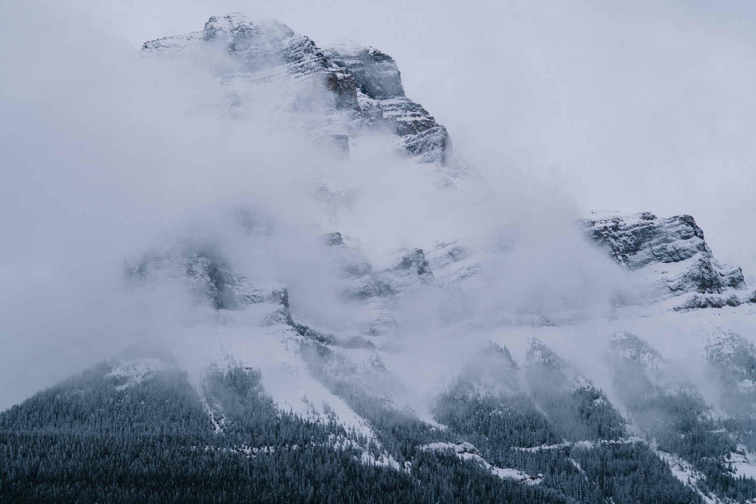
Fig. 3. Mt. Shasta, an active volcano on the west coast of the US, and is predicted to erupt again. With an elevation of 4321.8 m, Mt. Shasta is one of the highest mountains in the US. Some of the magmas that erupted from Mt. Shasta are Fe depleted. I took this photo in the summer of 2017.
The lithosphere, which is the outer shell of Earth, is broken into multiple plates. Sometimes at plate boundaries, one plate gets cold and dense enough and subducts beneath another plate. Most of the Fe depleted magmas are found at these plate boundaries where subduction happens. In subduction zones, the subducting plate brings down a lot oxidized surface materials. These oxidized surface materials may contaminate the mantle and generate oxidized magmas. As these oxidized and wet magmas rise into the crust, an Fe rich mineral called magnetite may crystallize and cause Fe depletion in the magma. All these sound perfectly reasonable, and this magnetite hypothesis has been the dominant solution to the Fe depletion problem for decades. Indeed, we do see magnetite crystals in many oxidized, Fe depleted rocks.
However, there are some fundamental observations that this magnetite hypothesis cannot explain.
Not all subduction zone magmas are Fe depleted.
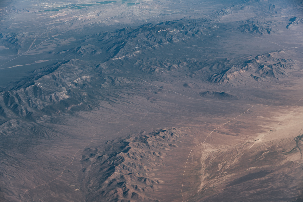
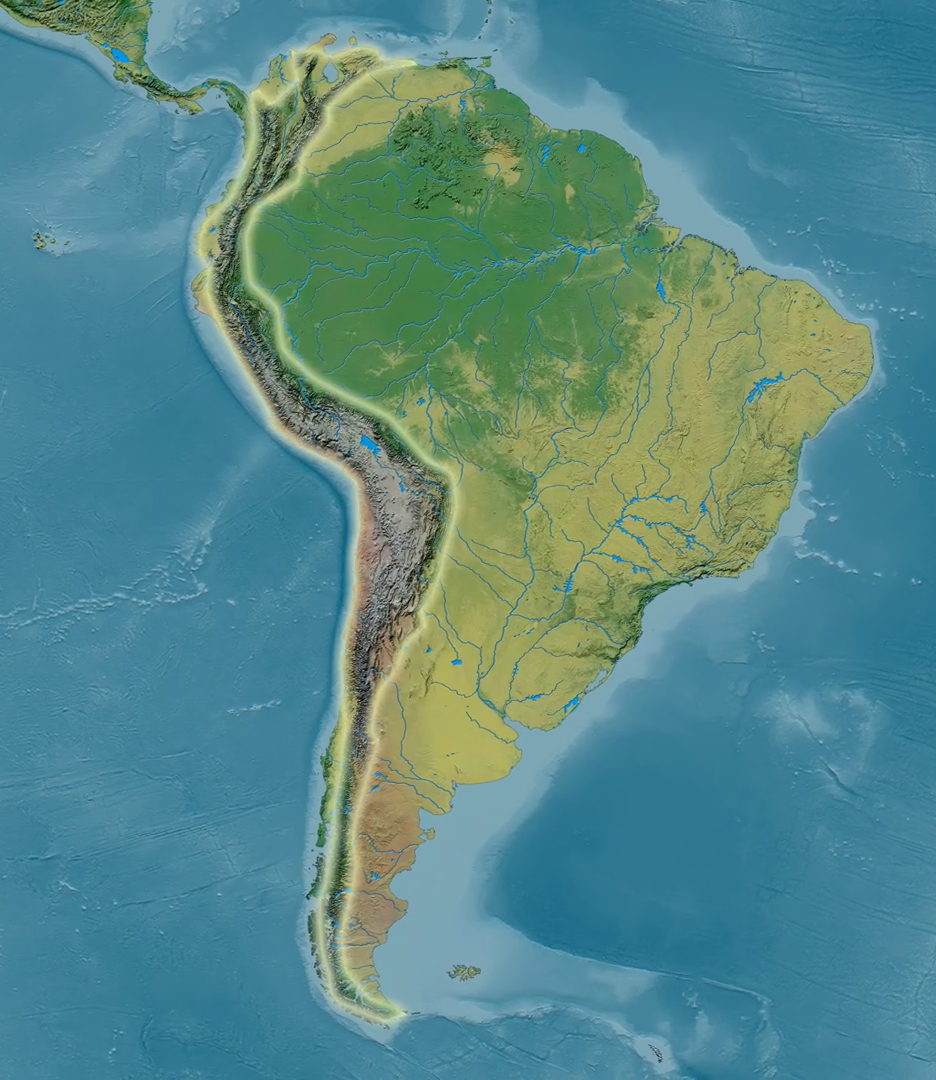
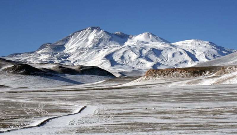
Back in the 1960s, a Japanese geologist, H. Kuno, found that in the Circum-Pacific volcanic belt, magmas become more Fe depleted from the ocean side toward the continent side. Today, we have more data and observations that support Kuno’s hypothesis 50 years ago, and what’s behind these observations is a crustal thickness control, that is, Fe depleted magmas are preferentially found in subduction zones built on thickened crust. For example, both Mariana arc in the west Pacific and Andean arc in the east Pacific are active subduction zones, but the crustal thickness differ significantly. In Mariana arc, the average crustal thickness is about 14 km while in Andean arc, especially the central part, the crust is thicker than 60-70 km. Mariana arc is dominated by Fe rich magmas whereas Andean arc is dominated by Fe depleted magmas. In effect, the composition of the Andean arc crust is much like that of the continental crust.
Why do Fe depleted, oxidized magmas like thickened crust? This is key to solving the mystery.
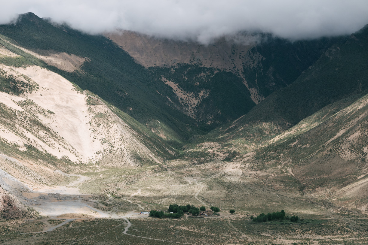
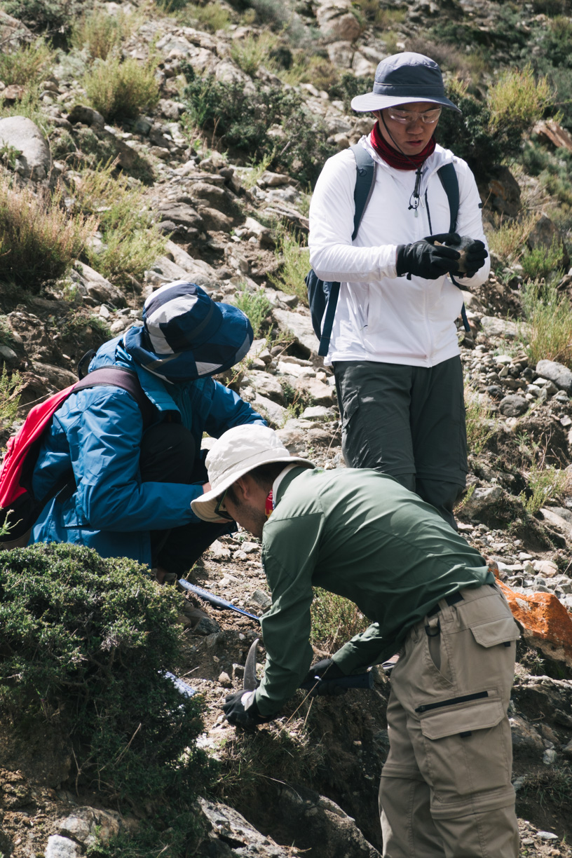
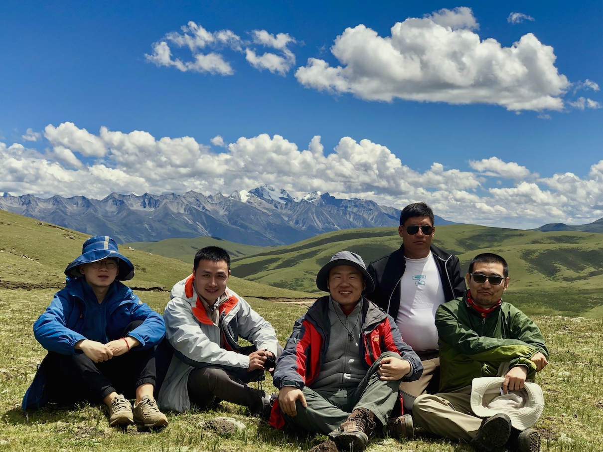
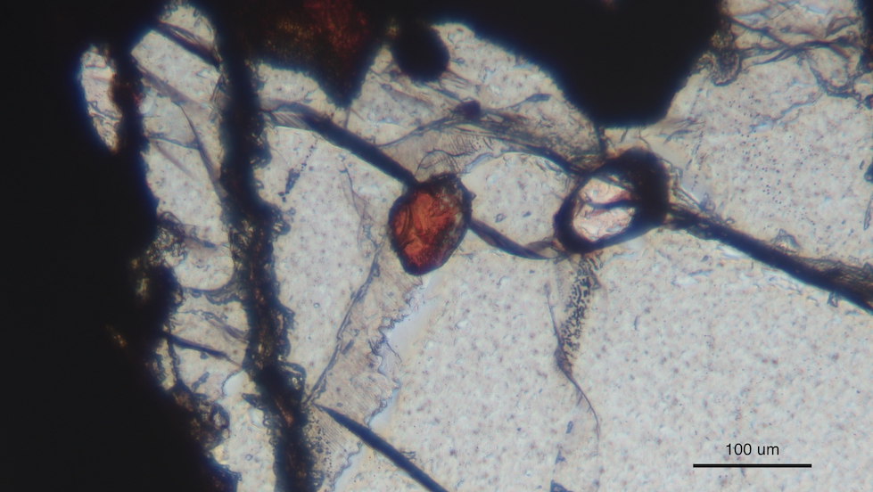
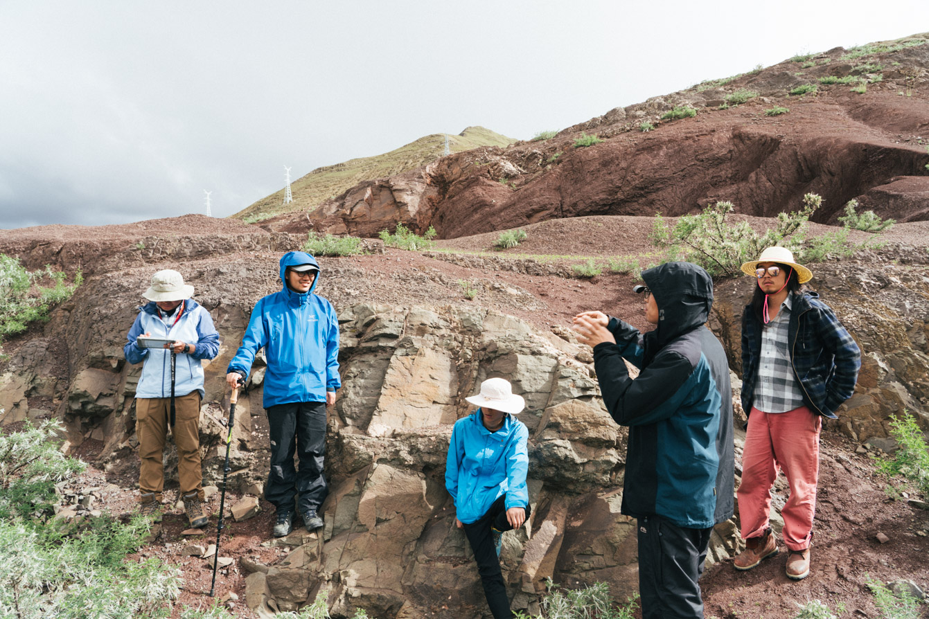
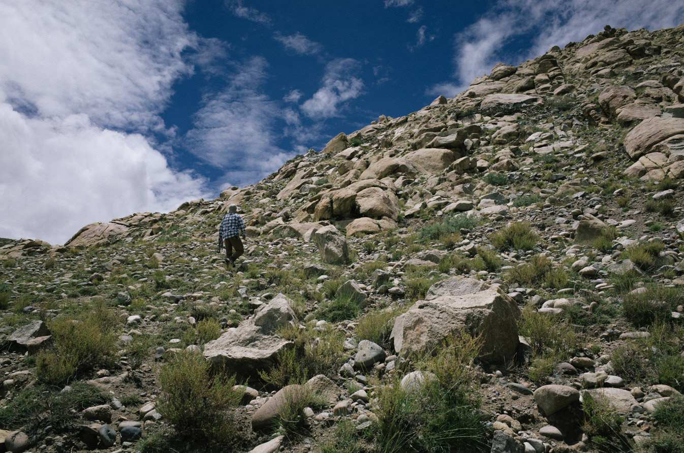
At the roots of thickened crust are rocks composed by the fractionated crystals, or the “dumped” minerals from magmas at great depths. Geologists call this type rocks cumulates. These cumulates are very dense, and are very rare at Earth’s surface. The reason that these cumulates do occasionally occur at the surface is that they may be accidentally brought up by some random but violent volcanic eruptions or some unusual tectonic processes. We were lucky to find some of these cumulate samples from Arizona, USA. Our cumulates formed at 60-80 km deep tens of millions years ago. These unusual samples tell the stories about what was happening in the deep crust that is otherwise largely inaccessible to us human beings.
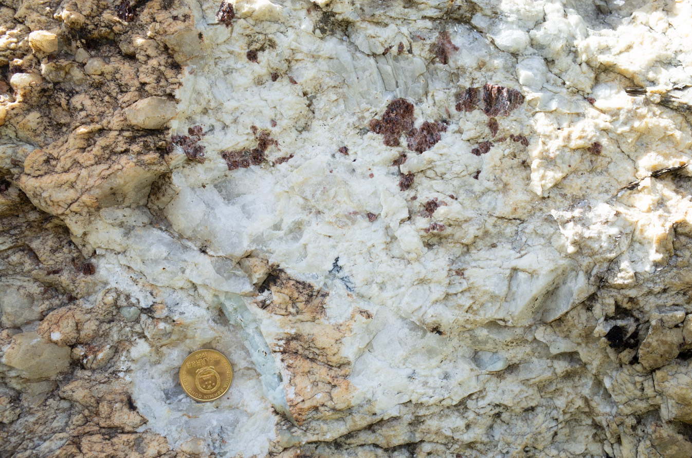
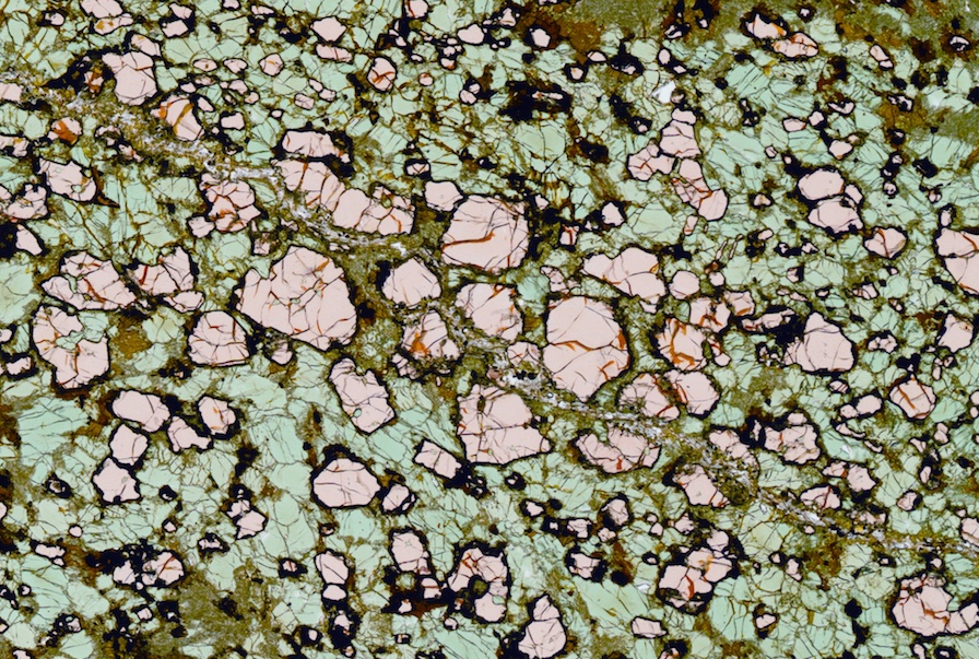
Fig. 4. A scanned image of our cumulate thin section. The pinkish minerals are garnets. They are up to 1mm in diameter. The greenish minerals are mostly clinopyroxene.
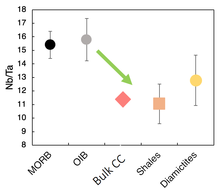
These deep cumulates are mostly composed of garnet and clinopyroxene, and are indeed rich in Fe! But magnetite doesn’t seem to be the most important Fe rich mineral. In fact, magnetite is absent in many of the cumulates. What else can carry so much Fe? Our attention was finally drawn by one of the major minerals in the cumulates—garnet. These garnets have up to ~18% Fe! Now everything starts to straighten up. Not all magmas can crystallize garnet. Garnet is only stable at high pressure and high water contents. This perfectly explains why Fe depleted magmas like thickened crust, or magmatic orogens, because magmas there are “capped” by a thick crust and therefore undergo crystal fractionation at high pressure. Only those magmas that go through thickened crust can crystallize garnet. An even more exciting thing about garnet is that garnet only takes Fe2+, so that its crystallization will increase the Fe3+/Fe2+ ratio in the magma. The oxidation state of a magma is mostly controlled by the average valence state of its Fe. So garnet crystallization will not only cause Fe depletion in the magma, but also oxidize the magma—the origin of the oxidized nature explained!
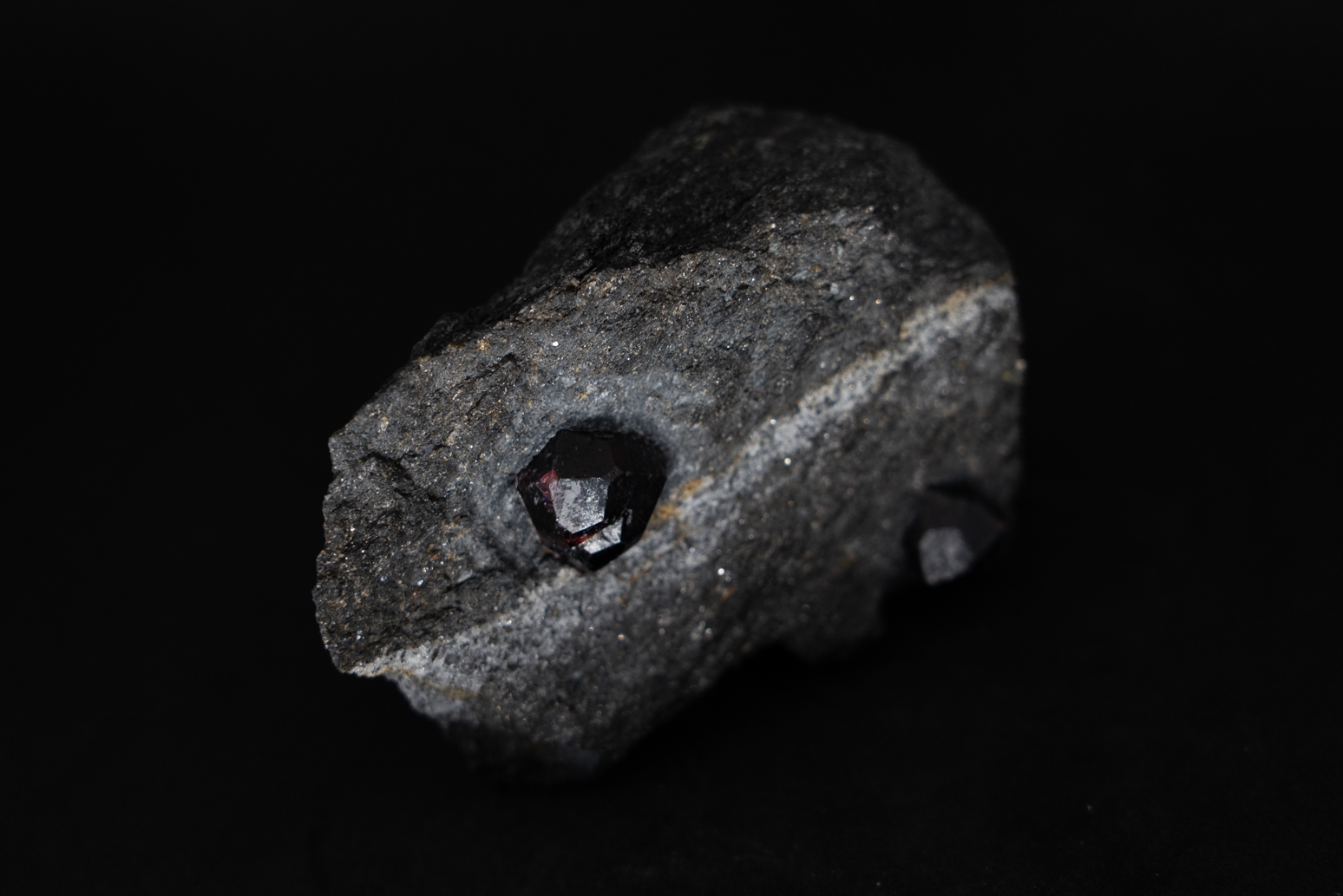
Fig. 5. Iron rich garnets from Alaska. These garnets are much bigger than the garnets we studied, and sometimes can reach gem quality. Garnet is also the birthstone of January.
Actually, this link between garnet and Fe depleted magmas was already noted by Trevor Green and Alfred Edward Ringwood in the 1960s. Ringwood is one of the fathers of modern petrology and geochemistry, and is highly respected. They found garnet phenocrysts in many Fe depleted magmas and carried out some experiments. Green and Ringwood published three papers on this topic from 1968-1972. Somehow, they didn’t continue in this direction, and this garnet model was forgotten by the community as the magnetite hypothesis became more and more popular. But it is really amazing that Green and Ringwood already thought about it 50 years ago! How much did we know about geology, about the continental crust, about subduction back in the 1960s? Even plate tectonics was just accepted by the scientific community at that time. They had far less data and knowledge about magma differentiation and crustal compositions, not to mention the rare deep cumulate samples that we have today.
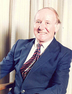
Fig. 6. A.E.Ringwood (1930-1993), an Australian experimental geophysicist and geochemist. The mineral ringwoodite is named after him. Photo credit: Australian Academy of Science.
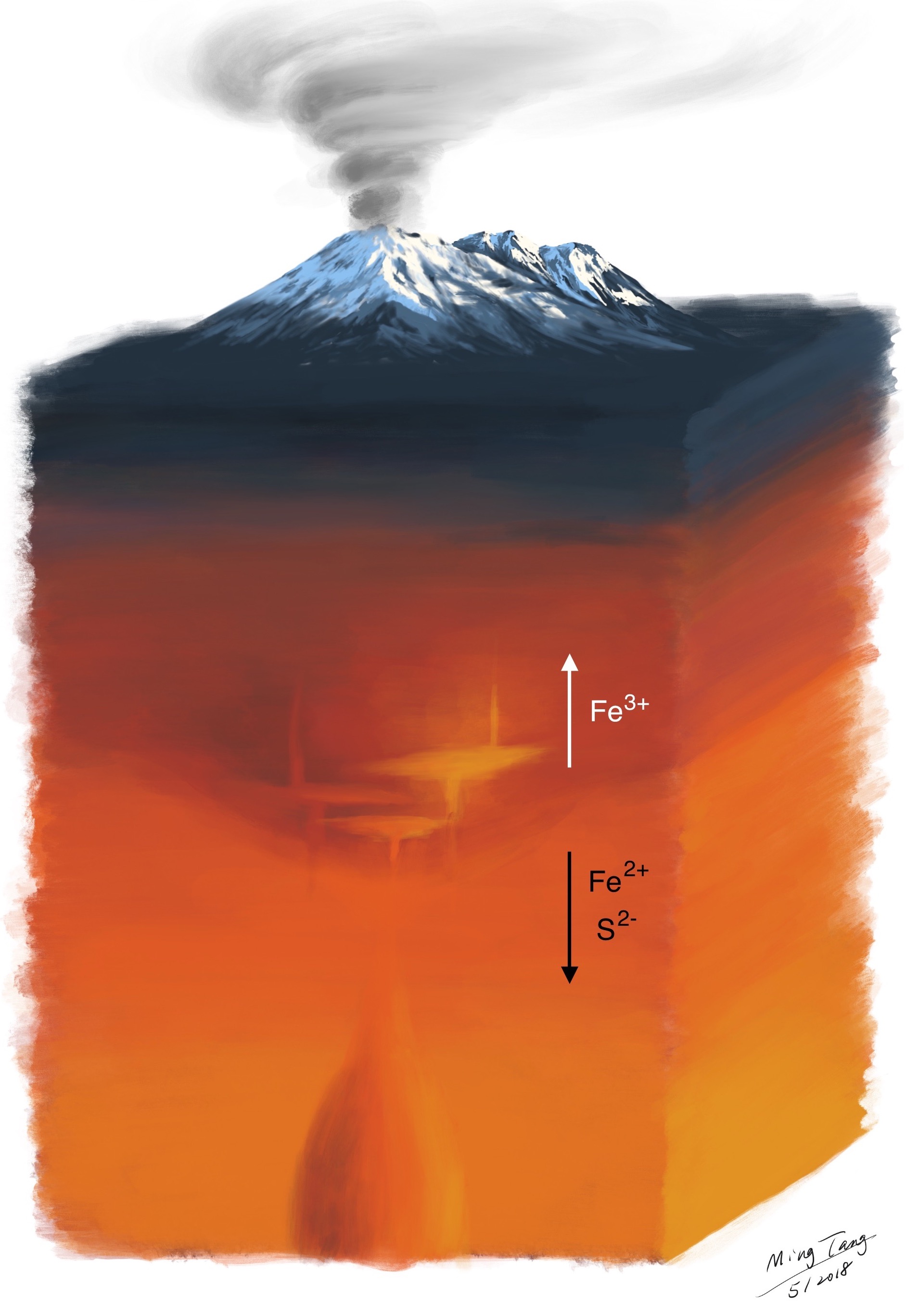
Nowadays, we may see the big pictures better than ever, thanks to big data geochemistry and those critical cumulate samples. Although nature is more complex than any single model can explain, this garnet hypothesis does seem to explain most of the observations in a self-consistent way. At the roots of the magmatic orogens, garnet keeps raining out from hot magmas coming up from the mantle. Like a filter, garnet crystallization changes the composition of the magma in the way that much of the oxygen-loving Fe2+ and toxic S2- are filtered out and locked in the deep crust, and will not make it to the surface with magmas. Garnet is dense, and it will not stay in the deep crust for long. Eventually, garnet will take all the Fe2+ and sulfides (S2- rich minerals) with it and sink into Earth’s deeper interior. Without garnet, Earth’s surface, including the atmosphere, might have been completely different. Free oxygen molecules may have never accumulated to the levels to sustain complicated life forms like us.
If this garnet hypothesis were correct, magmatic orogens, such as Andes where high altitude giant volcanos are typically seen, would be the primary factories of Earth’s continents. Just about every piece of the continental crust, our homeland, was born in such a violent and magnificent way. Today, we don’t see most of the mountains across the continents because they have been eroded away, but the Fe depleted nature of the crust preserves the memories of its past millions to billions of years ago.
Fig. 7. Cartoon illustrating garnet crystallization at the root of magmatic orogens, pulling the reducing Fe2+ and S2- out of the magmas. Cartoon not to scale.
]]>Generally, winter and early spring are not the best time to visit the Canadian Rockies unless you want go skiing or skating. Lots of places and roads are closed due to heavy snow or avalanche risks. Weather could also be harsh. But Xin and I went anyway. Instead of skiing, we snowshoed.
Some of my snow gears. Each one of us brought two pairs of shoes. It turned out to be a great idea since the shoes got wet easily but also dried fast. With two pairs of shoes, we were able to switch multiple times in a day.
After landing in Calgary on 3/10, we jumped into a rental car with snowtires (required) and started our 9-day Rockies trip. The map above has pretty much all of our trip stops.
Banff Town. Lots of restaruants, souvenir stores, inns and hotels.
Johnston Canyon, upper falls. An ice climber was preparing for his venture.
Mt. Rundle and its reflection in one of the Vermilion Lakes.
An overpass for wildlife to travel between different habitats. Trans Canada HWY, which cuts through Banff National Park, sees millions of cars each year, and would have caused serious roadkills without these overpasses (and underpasses in other places). These overpasses and underpasses have reduced animal collisions by 70%.
Canadian HWY 93 connects four national parks in the Rockies: Banff, Kootenay, Yoho and Jasper. This is one of the most scenic highways in the world. I took a lot of pictures on 93.
Ice and snow started to melt.
Marble Canyon in Kootenay National Park. There is another Marble Canyon in Arizona, US, which we also visited back in 2015.
A heart shaped snow patch!
A creek near Numa Falls in Kootenay National Park.
The same creek.
Xin standing in snow.
Radium Hot Springs in Kootenay! Soaked in for an hour. Very relaxing. I forgot to put on sunscreen and my face had a little sunburn after that…
Revisiting Numa Falls and the creeks in dusk, as we drove to Emerald Lake.
Snow in the creek.
Numa Falls creek in dusk.
Emerald Lake is such a pretty isolated place hidden in the heart of Yoho National Park. Across the bridge you enter the Emerald Lake Lodge. No private cars are allowed in the lodge area. They have a small bus to transport guests between the lodge and the lodge parking lot, which is about a km away. There was no cell phone reception, no WiFi, no TVs in the room, no connection with the outside whatsoever. Calm down and enjoy nature. We stayed in the Emerald Lake Lodge for two days.
Reading by the fireplace. It was very cozy inside the lodge.
Looking out of our window in the morning, we were a bit surprised by the fog over the lake. So quiet…
Walking in the lodge area.
Another shot in the lodge area.
A man walking across the frozen Emerald Lake.
Frozen trees.
Snowflakes falling from the trees, blinking in the winter sunshine.
Cottages near the lake.
Field, a small town inside Yoho, between Lake Louise and Emerald Lake. We found here when looking for restaurants on google maps. Field has less than 200 residents. Field is known for the Burgess Shale. CPR train track workers in Field discovered the fossils in the Burgess Shale back in the early 1900s. Burgess Shale later led to great scientific discoveries about early life on Earth. More information here. Unfortunately, the visitor center in Field was closed when we were there.
Field in snow.
Mountains surrounding Lake Louise. I took this shot after decending from a hill by the lake. Quite a venture since the decending trail we took was not maintained and was heavily covered by snow. Very slippery and we saw nobody during our decent. There was also a avalanche warning at the trailhead. Anyway, we made it, with snowshoes.
Xin snowshoeing on Lake Louise.
After Lake Louise, we started our Icefields Parkway journey towards Jasper. Once we were on Icefields Parkway, cell phone reception died. There are no gas stations, rest areas, nothing for the next 232 km until one reaches Jasper. In the winter, the highway can be partially or completely covered by snow and ice. So need to be very careful. All that said, it is very scenic and rewarding.
Bow Lake. Completely frozen and covered by snow.
A wood bridge. Snow covered everything…
A huge crow standing in the snow. Our car got stuck in the snow when we tried to pull out from the shoulder…We were a bit scared, but thankfully, two backcountry skiers stopped by. They first shaveled the snow and ice beneath our front wheels, and then put snowshoes beneath them to give the car a bit more friction. Then they pushed the car out. Xin gave them a box of maple cookies to thank them.
Bow summit, overlooking Peyto Lake. Peyto Lake is a gem in Banff. It was frozen and all white when we were there, but still pretty.
Glacier valley.
Mountain behind the pine trees.
We drove back to Lake Louise to stay the night. The next day was like a snowstorm.
Snowshoeing to see the Athabasca Glacier. We didn’t see it because the visibility was so low that day. Everything was white and bright. And it was snowing all the time. But snowshoeing in such a wild place was fun. It was just the snow, mountains, Xin and me.
How everything looked like…My eyes could hardly find anything to focus on.
The next day was much better. Gloomy but no snow or rain.
A snowplow.
Medicine Lake.
A white peak.
Maligne Lake Rd.
Athabasca Falls.
The canyon beneath Athabasca Falls.
The canyon.
Mt. Hardisty in mist.
The last day, driving back to Calgary.
Icefield Parkway.
Mountains in snow.
Icefield Parkway. Looks like avalanche is possible here.
Icefield Parkway.
Well, we were able to see Athabasca Glaciers on our way back…
Icefield Parkway.
]]>